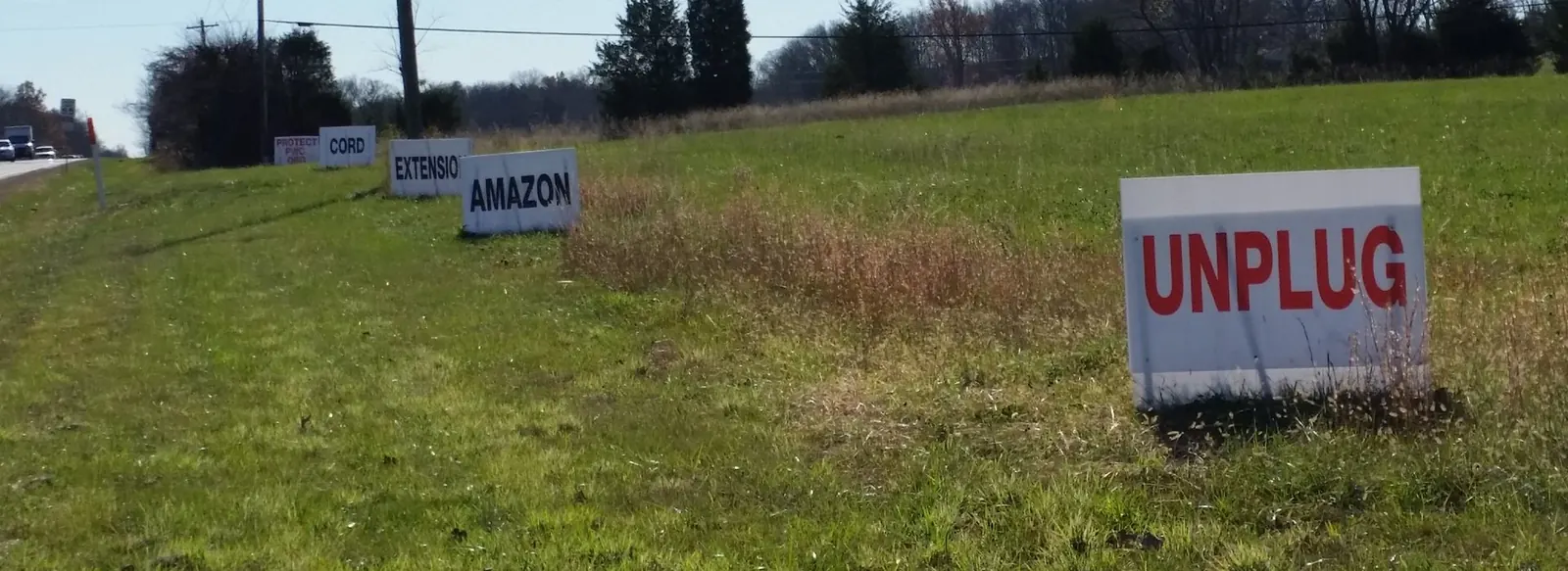
Dominion Energy 7/30/18 – Confirm partially buried I66 route for Haymarket Transmission Line – Amazon Extension Cord
From: Powerline@dominionenergy.com [mailto:Powerline@dominionenergy.com]
Sent: Monday, July 30, 2018 1:47 PM
Subject: Project Update: Haymarket Transmission Project, I-66 Hybrid Route Approved
On Thursday, July 26, 2018, the Virginia State Corporation Commission issued its final order approving the Haymarket transmission project and including it in the underground pilot program, as outlined in the Grid Transformation and Securities Act of 2018*. Their decision moves us one step closer to meeting the growing energy demands in western Prince William County. This represents another milestone that took thoughtful and patient hard work by all involved. We appreciate the collaborative effort it took to find a solution. Our focus is to complete this project in a courteous and respectful manner for the benefit of the region.
We are still a fair ways out from starting construction. Now that we have a final order, we will work in earnest to finalize our design and construction plans. As we move through the next steps in the process, we will continue to keep the community aware of our activities.
We will continue to keep you informed as developments occur. For project information and updates, please visit https://dominionenergy.com/haymarket
For general information regarding construction-related activities, please visit www.dominionenergy.com/virtualopenhouse
As always, we appreciate the community’s patience and continued involvement in this project.
Thank you,
Greg Mathe
Dominion Energy Electric Transmission Communications
*The Grid Transformation and Securities Act of 2018 included a section establishing an electric transmission underground pilot program, which we supported. The legislation was signed into law on March 9, 2018 and went into effect July 1, 2018.
———-
From: Powerline@dominionenergy.com [mailto:Powerline@dominionenergy.com]
Sent: Thursday, July 12, 2018 3:19 PM
Subject: Haymarket Electric Transmission Project Update: Company Files for I-66 Hybrid Route Approval
On the heels of the recent June 12 Virginia State Corporation Commission (SCC) order reaffirming the need for the Haymarket transmission line, we have now submitted to the SCC our official request to include the I-66 Hybrid Route in the underground electric transmission pilot program. We look forward to gaining approval within the 30 day timeframe as set forth in the legislation* which went into effect July 1.
A postcard was sent out this week to update the community on the status of the project and we are attaching it to this email as well.
Our request represents another milestone that took thoughtful and patient hard work by all involved. This collaborative effort will help maintain reliable electric service for the communities in western Prince William County.
We will continue to keep you informed as developments occur. For project information and updates, please visit https://dominionenergy.com/haymarket
As always, we appreciate the community’s patience and continued involvement in this project.
Thank you,
Greg Mathe
Dominion Energy Electric Transmission Communications
*The Grid Transformation and Securities Act of 2018 included a section establishing an electric transmission underground pilot program, which we supported. The legislation was signed into law on March 9, 2018.
Dominion Energy postcard regarding Haymarket project – 071218: Haymarket Postcard_FINAL 7.5.18
Adverse Impacts
Comprehensive Adverse Impact Analysis Report
5 Quick Facts about the Proposed Transmission Lines
Birds and Bats must be Protected!
Resource Protection Areas (RPAs) are in the Power Line Paths!
Five Quick Facts…
Five Quick Facts About the Proposed Amazon.com Power Towers
Each overhead route would cost county residents and businesses tens of millions of dollars — and threaten billions of dollars of the county’s tax base.
In fact, the “New Road” alternative would cost Prince William County between $1.14 million – $4.38 million annually in lost property tax revenue.
Two overhead route alternatives — the “Western” and “New Road” options — would devour 152 and 177 acres of Rural Crescent landscapes.
The herbicides Dominion Power would use to clear vegetation under Amazon’s overhead power towers will kill millions of honey bees, destroy fish and other wildlife habitats and pollute the Chesapeake Bay.
Dominion’s own documents show that the “I-66 Hybrid” alternative — which would partially bury a transmission line along Interstate 66 — would be far less environmentally disruptive than the above ground routes.
Adverse Impact Analysis Reports
NOTE: The analysis documents included below were independently prepared by community representatives affected by different Dominion Virginia Power transmission route proposals.
The Coalition will only advocate for I-66 and buried (Hybrid) … and Amazon pays
1. I-66 Overhead alternative – no community representatives have prepared analysis
2. I-66 Hybrid alternative – no community representatives have prepared analysis
3. Railroad Alternative (6.0 miles)
4. Carver and Madison Alternatives
5. Northern Alternative Route (6.1 miles)
6. New Road Alternative Route (12.2 miles)
7. Western Alternative Route (10.5 miles)
Adverse Impact Analysis for the ‘New Road’ Alternative Route (12.2 miles)
HISTORICAL: The New Road Alternative Route is in conflict with over 35 documented historic places containing 3 National Registered Historic Sites, 5 state and county registered sites, numerous Civil War plats/graves/trails, The Daughters of the Confederacy Chapel, multiple slave community areas including 2 churches; 4 known slave grave sites, passage of the Underground Railroad, and the National Heritage Area Act for the scenic byway defined by the 2014 “The Journey Through Hallowed Ground” management plan. Section 106 of the National Historic Preservation Act of 1966 “… requires that … permitted projects consider its effects on properties that are listed or are eligible for listing on the National Register of Historic Places.” Additionally, “Serve Our Willing Warriors,” a planned retreat for tens of thousands of our nation’s veterans is located directly in the path of this route, along with Camp Snyder, a camp for the Boy Scouts of America.
Historic Sites listed in order moving south from New Road:
- Old Carolina Road (aka Rte. 15; Rogue’s Rd.; Loudoun Dr.) 1700s-current JTHG ACT
- Enfield Estate (Revolutionary & War of 1812; Civil War; 2 mill sites)
- Taylor’s House Mill (Historic Registry processing; mill site)
- Bunker Hill (slave grave yard; Civil War)
- Dumblane/Edge Hill (Civil War, Grave Site)
- Ewell’s Estate
- Ewell’s Chapel 1864 (Civil War Skirmish; Historic)
- Edge Hill
- Waterloo
- Locust Bottom (National Register of Historic Places)
- Hickory Grove (Hundred Oaks)
- Evergreen Estate (Manor House; Civil War; National Register of Historic Places)
- Foley’s Woods
- Mill Creek
- Mt. Atlas (National Register of Historic Places)
- Oak Shade (Shirley’s School)
- Waterfall Park
- Olive Branch Church and Graveyard (Virginia Slavery Inventory)
- Allen House
- Bull Run Chapel (Daughters of the Confederacy)
- Brown’s (Dean’s) Mill
- Foley’s Mill
- P.O. & Foley’s (G.A. Gossem’s) Store
- Pickett’s (Sinclair’s) Mill
- Antioch Church and Graveyard (Historical Marker Database, Civil War)
- D. Murray’s Store
- Murray’s Shop
- La Grange (Prince William County’s First Vineyard)
- Howell’s Saw Mill
- Oakrum Church (Virginia Slavery Inventory)
- Moore’s Store
- P.O. & Howells Store
- Railroad Station
- Thoroughfare/Carters Switch (community founded by former slaves)
- African American Heritage Sites (The Underground Railroad)
LEGISLATIVE: The New Road Alternative route is the longest of any alternative and does not use any existing Right-of-Way. Instead, it requires acquisition of more than 12 miles of new ROW easements through an area outside of the “Designated Corridors or Routes for Electric Transmission Lines of 150 Kilovolts or More” delineated in the Prince William County Long Range Plan. Running a double 230kv through the Rural Crescent where it will serve NO development is in complete contradiction with Prince William County’s long-term goals to preserve open space. The Rural Crescent was never intended to serve as a massive transmission line route.
ENVIRONMENTAL: The 12.2 span of the New Road Alternative route would destroy over 177 acres – or nearly 8,000,000 square feet – and is in direct conflict with the Prince William County Land Use Plan for the Rural Crescent. It will encroach on Resource Protection Areas (RPAs) and wetlands designated by both the Chesapeake Bay Protection Act and the U.S. Fish and Wildlife Service. Specifically, this route would cross at least 10 RPAs at nearly 2,200,000 square feet and over 50 acres of RPA destroyed. Countless species of animals, including the protected American Bald Eagle, call this area home. Chemicals and herbicides used beneath such high-voltage power lines have been proven to cause Colony Collapse Disorder in honey bees, not to mention permanent contamination to drinking water, soil, streams, ponds, and ultimately the Chesapeake Bay. (The 5.8 mile I-66 Hybrid Route, proposed by Dominion Power and the only acceptable route to the Coalition, crosses zero RPAs).
FINANCIAL: The primary impact of Dominion’s proposed above-ground lines will be to property owners who (a) have property seized for right-of-way and (b) have directly adjacent property impaired, totaling tens of millions of dollars. The negative impact to property values ranges from $10 – $12MM in direct impact, and local real estate appraisers believe the impact could be upwards of $40MM. The hundreds of properties directly impaired will have an impact on several thousand properties when it comes time to sell, to refinance, or to seek a home equity loan. Secondary impacts of Dominion’s proposed above-ground lines will be to businesses (for example, La Grange Winery, Evergreen Country Club, Bull Run Golf Club), non-profits (Wounded Warrior, Camp Snyder), and farms operating near the line who depend in part or in whole on customer or donor revenue. Other impacts of Dominion’s proposed above-ground lines will be to parties with interests in the properties, including homeowners in the surrounding area whose values depend on general conditions, county tax authorities, and holders of mortgages. Hundreds of millions of dollars in residential property value and associated tax revenue are at-risk.
Adverse Impact Analysis for the ‘Northern Alternative’ Route (6.1 miles)
Piedmont and Heritage Hunt (a Senior 55 Plus community) are nestled in the foothills of the Bull Run mountain range, home to epic civil war battles and a critical part of our nation’s history. Our communities have almost 3500 homes, two signature golf courses, and are adorned by Little Bull Run Creek, a tributary of the Chesapeake Bay. Beyond Piedmont and Heritage Hunt, the “Northern Route” will directly impact Conway Robinson Memorial State Forest, Parks at Piedmont, Carolina Estates, West Market, and countless other individual properties and businesses.
HISTORICAL: Conway Robinson Memorial State Forest: Historic 444 acre property with direct ties to the first battle of Manassas and donated with NATIONAL preservation in mind, not as an easement. It is the ONLY State Forest within a growing urban environment. Conway Robinson is a wonderful resource for school curriculums.
ENVIRONMENTAL: The proposed Northern Route impacts virtually every environmental item you could think of including: Endangered species impacted from mussels to mammals, bats, turtles, etc. Loss of local fruit and plants due to lack of pollination. The high voltage power lines are known to disrupt a bee’s natural environment and pollination efforts. Wetlands earmarked for protection, decimated. Chesapeake Bay Water Shed – Little Bull Run creek is well within the watershed and feeds the Bay. Toxic chemicals and disruption from construction will flow to the bay. Habitat destruction for many species including the Cardinal, VA state bird. Historic Oak Tree on the Virginia State Registry of specimen trees. Mile plus of old growth hardwoods lost. Ecosystem disruption and destruction. Functional loss of equestrian and pedestrian trails, permanently. And, at least 831,000 square feet in RPA crossed and nearly 20 acres of RPA cleared
FINANCIAL: The Coalition’s very conservative economic modelling of residential property value impairment using journal-published articles and professional real estate appraisal guidance found approximately 551 homes would be impaired by between $13K and $18K each, for a total of $7-10M. Local home owners and real estate experts see the potential for a more catastrophic loss given the integral nature of the golf courses and other amenities to the quality of life and home values in the relevant communities
- Est. 200 homes with 30% values loss or $20+ million
- Est. 3500 homes with a range of 2-20% value loss or $150-200 million combined
- Almost non-existent resale for Heritage Hunt and significant loss for Piedmont
- Lost taxes for the county and town
- HOA deterioration to infrastructure due to inability to increase related fees, therefore eroding quality of the community and attracting new residents.
- Piedmont Club & Heritage Hunt: Lost revenue due to reduction in current and future memberships, fewer corporate functions, fewer weddings and private events, fewer charitable outings, reduction in staff, etc. Golf course continued viability in doubt at Heritage Hunt – 3 holes rendered unplayable due to Dominion power lines.
Local business supported by the various communities will see a significant loss of clientele and revenue as the communities are no longer attractive to current residents and future buyers. Directly-related business such as medical & extended living support in place to support Heritage Hunt would suffer.
Adverse Impact Analysis for the ‘Railroad Alternative’ Route (6.0 miles)
The TOWN OF HAYMARKET ROUTES:
Featuring the RAILROAD ALTERNATIVE
The Town of Haymarket Routes have included three variations, including Dominion’s Railroad Alternative Route. The route analysis below is from the Town of Haymarket Report on Datacenter and Powerline https://protectpwc.org/2014/12/12/town-of-haymarket-report-on-datacenter-and-powerline/
A. Dominion’s Preferred Preliminary Route (aka Railroad Route)
- The routes bisect two heavily populated residential subdivisions.
- The routes bisect several commercial parcels within the Town.
- The routes traverse most of the Town’s Conservation District.
- The routes traverse two of the Gateways into the Town’s Historic District.
- The routes traverse that area of the Town that constitutes a portion of the Journey Through Hallowed Ground.
- Given the power demands of the new datacenter (100mw), the new transmission lines will not provide capacity for additional future growth.
- The aesthetics of the design creates a visual image that is not in concordance with the Town’s Historic District ordinances.
- The routes are not in accordance with the Town’s Comprehensive Plan.
- The routes are not in accordance with Prince William County’s Comprehensive Plan.
- The routes, terminus point and proposed substation are not located in the principal area of future residential, commercial and industrial growth.
- The overhead routes will adversely impact the value of many existing residential units.
- Diminished property values do not appear to be explicitly considered as a factor by the SCC.
- The routes will adversely impact several existent commercial properties in the Town’s southwestern corner.
- The routes will be constructed largely within the 100-year flood plain.
- The routes will traverse several designated wetlands.
- The routes may jeopardize the Town’s ability to comply with the provisions of the Chesapeake Bay Act.
- Upon information and belief, the routes will traverse areas containing several endangered species.
- In addition to the fiscal impact that will be absorbed by residential ratepayers, many of those residential ratepayers within the Town limits will also have to absorb the visual impact of the overhead lines on their viewshed.
- The overhead lines would allow for the construction of substations and communication arrays on the towers and within Dominion’s ROW without public hearings or public facilities reviews.
- Upon information and belief, Dominion has not negotiated with the Norfolk Southern Railroad (NS) regarding use of NS’s existing ROW.
- The overhead routes have a ROW that is severely limited by existing utility and railroad ROWs and numerous conservation easements.
- Due to environmental and topographical constraints, placing the transmission lines underground would be prohibitively expensive.
- Due to environmental and topographical constraints, placing the transmission lines underground would present significant engineering challenges.
- The overhead routes present a potential health hazard.
B. Dominion’s Alternate Preferred Preliminary Route and Public Input Preferred Alternate Preliminary Route (South of I-66))
- The routes pass through at least eighteen (18) residential lots.
- The routes cross four heavily populated residential subdivisions.
- The routes cross several commercial parcels within the Town.
- The routes traverse most of the Town’s Planned Interchange Park.
- The routes traverse two of the Gateways into the Town’s Historic District.
- The routes traverse that area of the Town that constitutes a portion of the Journey Through Hallowed Ground.
- Given the power demands of the new datacenter (100mw), the new transmission lines will not provide the capacity for additional future growth.
- The aesthetics of the design creates a visual image that is not in concordance with the Town’s Historic District ordinances.
- The routes are not in accordance with the Town’s Comprehensive Plan.
- The routes, terminus point and proposed substation are not located in the principal area of future residential, commercial and industrial growth.
- The overhead routes will adversely impact the value of many existing residential units.
- Diminished property values do not appear to be explicitly considered as a factor by the SCC.
- The routes will adversely impact several commercial properties in the Town’s northwestern corner.
- In addition to the fiscal impact that will be absorbed by residential ratepayers, many of those residential ratepayers within the Town limits will also have to absorb the visual impact of the overhead lines on their viewshed.
- The overhead lines would allow for the construction of substations and communication arrays on the towers and within Dominion’s ROW without public hearings or public facilities reviews.
- The overhead routes present a potential health hazard.
C. Dominion’s Alternate Public Input Alternate Preliminary Route, North of I-66
- The route traverses the Town’s Planned Interchange Park.
- The route traverses one of the Gateways into the Town’s Historic District.
- The route traverses that area of the Town that constitutes a portion of the Journey Through Hallowed Ground.
- Given the power demands of the new datacenter (100mw), the new transmission lines will not provide the capacity for additional future growth.
- The aesthetics of the design creates a visual image that is not in concordance with the Town’s Historic District ordinances.
- The route is not in accordance with the Town’s Comprehensive Plan.
- The route, terminus point and proposed substation are not located in the principal area of future residential, commercial and industrial growth.
- The overhead route will adversely impact the value of many existing residential units.
- Diminished property values do not appear to be explicitly considered as a factor by the SCC.
- The route will adversely impact a large commercial parcel in the Town’s northwestern corner.
- In addition to the fiscal impact that will be absorbed by residential ratepayers, many of those residential ratepayers within the Town limits will also have to absorb the visual impact of the overhead lines on their view shed.
- The overhead routes present a potential health hazard.
Adverse Impacts of ‘Western’ Alternative Route (10.5 miles)
The 10.5 mile Western Route, which is located primarily in Fauquier County, impacts 152 acres and includes numerous significant sites; including Battlefield Baptist Church, Buckland Farms, and Vint Hill Farms. Six (6) RPAs will be crossed – over 600,000 square feet, and nearly 14 acres of RPA cleared.
The adverse impacts to these sites and this region, which is also part of the Journey Through Hallowed Ground, are just as detrimental as those noted in the other routes.
(If anyone affected by the Western Route has further input on adverse impacts, please provide it)
Carver Road and Madison Routes
Summary
Two routes recently released by Dominion Virginia Power (DVP) as potential route alignments for the Haymarket Project – the Carver Road and Madison alternatives – could destroy residential property values in effected communities such as Somerville Crossing, Hopewell’s Landing, and Carver Road anywhere from $3.3 million to $6.0 million. These value are in line with analysis conducted on other routes by the Coalition to Protect Prince William County. These estimates are conservative and omit businesses, apartments, and unimproved property.
Background on Model and House of Delegates Testimony
The Coalition economic team uses two models to assess likely residential property value impairment. A 2013 peer-reviewed article from The Appraisal Journal found home values in Seattle faced impairments ranging from 3-12%, with high-value homes suffering the most (we call this the Value Trigger Model). A series of published studies and testimony from 1993-2010 found home value impairments ranging from 5% up to 36%, with a likely range of 10-20%, driven primarily by how far the structure stood from the high-voltage line (we call this the Proximity Model). We assumed properties with homes 200 feet from DVP’s proposed line would be at the high end of this range, while properties with homes 200-500 feet from the line would be at the low end. In most cases, results will vary. As real estate expert and small business owner Kim Bradley told the House of Delegates when presenting this study in February of 2015, “The only way to truly assess the impact of high-voltage transmission lines on a property is to complete a full appraisal.”
Our findings in February were disturbing. Besides property directly seized for right-of-way or easements, DVP’s proposed overhead power lines will impair residential home values by as much as $7 million to $10 million, depending on the route.
Updating the Analysis for New Route Alternatives
Since February, DVP has published new overhead route alternatives. Two of these – the Carver Road and Madison alternatives – pose the greatest threat to residential properties.
Coalition team members studied over 1,000 individual properties within 2,000 feet of DVP’s proposed Carver Road and Madison alternatives (these lines follow the same path for part of their route, and so were studied together though individual properties would in some cases experience different impacts under different route scenarios). We then eliminated unimproved properties, a large church property, and businesses. We finally assessed property locations for distance from the proposed lines and obtained assessed tax values to serve as a starting point for value impairment. Our findings were similarly devastating.
| Route | In-Range Residences | Value Loss, by Model | ||
| Narrow (500 ft.) | Broad (2000 ft.) | Value Trigger | Proximity | |
| Carver Road | 90 | 850 | $5.11M | $3.32 |
| Madison | 110 | 831 | $6.00M | $4.78 |
Individual homeowners could face significant losses, depending on the concentration of impairment. In the Proximity Model, the most concentrated, the average property owner on or near the Carver Road alternative would lose over $36,000 in value to impairment. On the Madison alternative, the same model projects the average homeowner would face over $40,000 in lost value.
As noted above, some published real estate studies show a 36% value impairment caused by high-voltage transmission lines crossing or approaching residential property. For the average property owner in the broad sample considered, this extreme loss would amount to over $140,000 in lost value.
Limits to the Model
These numbers are conservative, as they omit potentially millions of dollars in property impaired directly via right-of-way seizure; omit townhouses or apartments; omit houses of worship (some with over $2M in property near one or both of the proposed route alternatives); use Prince William County assessed tax values, which undershoot market value and lag sales and/or construction completion; omit a few hard-to-spot properties with obscured structures (we did not hand check every property); exclude undeveloped property (include a $9M parcel belonging to the University of Virginia Foundation) and exclude direct or indirect impact to businesses (well over $10M in property at risk).
Generalized Or Otherwise Hard to Establish Impacts
This model also omit dynamic effects, such as the impact directly impaired properties may have on those which serve as comparables or support overall market values. All county property owners depend on comparables and general market conditions to help preserve home values, which for most individuals is the largest single investment they will ever make. The hundreds of properties directly impaired or thousands bearing some impact will have follow-on effects on ten thousand or more when it comes time to sell, to refinance, or to seek a home equity loan.
High-voltage overhead transmission lines may also have downside impacts on properties which depend on aesthetic appeal for part of their value, including residential communities. One quite illustrative example is the in-progress development of The Villages of Piedmont at Leopold’s Preserve, which sits just west of Route 15 / James Madison Highway. While none of the development’s current home are within 200 or even 1000 feet of a proposed transmission line, DVP’s Madison alternative would place a high-voltage transmission line directly across the entrance of this development, which has set aside 380 of its 500 acres as a permanent conservation easement. Ironically, the “Leopold” in the development’s title refers to Aldo Leopold, a famous American environmentalist, wildlife management pioneer, and founder of the Wilderness Society.